
The treasure we know today as the Mapungubwe National Park and World Heritage Site has a troubled recent history. In 1918 already the corner of our country where the borders of South Africa, Botswana (then the British protectorate of Bechuanaland) and Zimbabwe (then still the British colony of South Rhodesia) met was set aside as a botanical reserve due to the area’s unique plant communities. It soon became known as the Dongola Botanical Reserve. In March 1947, with its size much reduced to placate the local farming community, the South African government proclaimed the Dongola Game Reserve at the confluence of the Shashe and Limpopo Rivers. A change in government the following year however resulted in the fledgling conservation area being deproclaimed in its entirety almost immediately. A tiny portion of it, surrounding the Mapungubwe Hill, became a provincial nature reserve, Vhembe, in 1967. Then, in 1995, with South Africa now a multiracial democracy and Botswana and Zimbabwe independent countries in their own right, and after many years of a strict military presence on the border, this arid corner of our country was once again afforded the highest level of protection as the Vhembe-Dongola National Park. In September 2004, the park was opened to visitors and renamed the Mapungubwe National Park, in recognition of the fact that this area and its rich cultural heritage centred on Mapungubwe Hill was inscribed as a World Heritage Site the year before.
")
Misty morning along the Limpopo River
")
Interesting rock formation in Mapungubwe
")
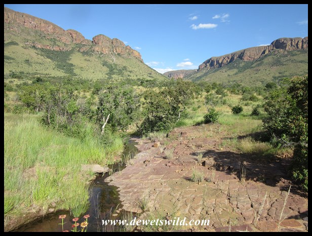
Mapungubwe scenery
")
High hills towering over fertile plains
")
A herd of wildebeest in the foreground appears tiny in Mapungubwe’s vastness
Mapungubwe’s human history dates back to hundreds of years before the colonial period however and is extremely fascinating. Visits to the interpretive centre near the gate and the archeological site on Mapunguwe Hill are not to be missed. Read more about it here.
")
Mapungubwe’s interpretative centre has a model of the famous golden rhino
")
Mapungubwe Hill seen from the northwest
Today, Mapungubwe covers 28,000 hectares and consists of two distinct parts, with private farming land isolating the two sections. Both sections adjoin the Limpopo River; the eastern portion is rugged and hilly – with beautiful baobab trees – while the western section is flat and dominated by a very different community of plants. Mapungubwe’s an arid place, with average annual rainfall below 400mm and summer temperatures that easily soar above 40°C.
")
Impala Lily (photo by Joubert)
")
Bushveld Candelabra Euphorbias
")
Eland silhouette in Mapungubwe National Park
")
Mapungubwe Baobabs
")
Baobabs dotting the Mapungubwe landscape
")
Iconic Mapungubwe: baobabs, elephants and rocky outcrops
Poacher’s Corner is an especially beautiful stretch of road through the riverine forest on the southern bank of the Limpopo.
")
Tree-lined banks of the Limpopo River at Poacher’s Corner
")
A rainy day at Poacher’s Corner
")
Cliffs on the Zimbabwe side of the border loom over the Limpopo River
")
Poacher’s Corner, on the Limpopo River
Near Poacher’s Corner is Zebra Pan, itself a delightful place to park your vehicle and gawk at the constant stream of wildlife
")
Zebra Pan near Poacher’s Corner
")
Zebra Pan near Poacher’s Corner
")
Zebra Pan near Poacher’s Corner
The Maloutswa Pan and Hide in the west of the Park is yet another great spot to spend a few peaceful hours waiting for the birds and animals to come quench their thirst within easy reach of your lens.
")
The Hide at Maloutswa Pan
")
The Hide at Maloutswa Pan
")
Maloutswa Pan
")
Maloutswa Pan
")
Wildebeest and impala nervously approaching Maloutswa Pan
Set atop a hill several lookout decks have been constructed from which to view the confluence of the Shashe and Limpopo Rivers where the borders of the three countries meet. Near the car park there are also a few picnic tables and braai (barbeque) stands which are very popular with visitors to Mapungubwe.

Meeting place for three countries: The confluence of the Limpopo and Shashe Rivers
")
Limpopo River at sunrise
")
A deck with a view over the confluence of the Limpopo and Shashe Rivers
")
A deck with a view over the confluence of the Limpopo and Shashe Rivers
")
The Picnic Area at the Confluence Viewpoint
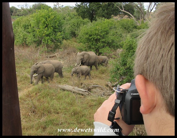
The Treetop Walk on the bank of the Limpopo River is another place visitors to Mapungubwe National Park should not miss.
")
Elephants at the Treetop Walk
")
Mapungubwe’s Treetop Walk on the bank of the Limpopo River
")
Mapungubwe’s Treetop Walk on the bank of the Limpopo River
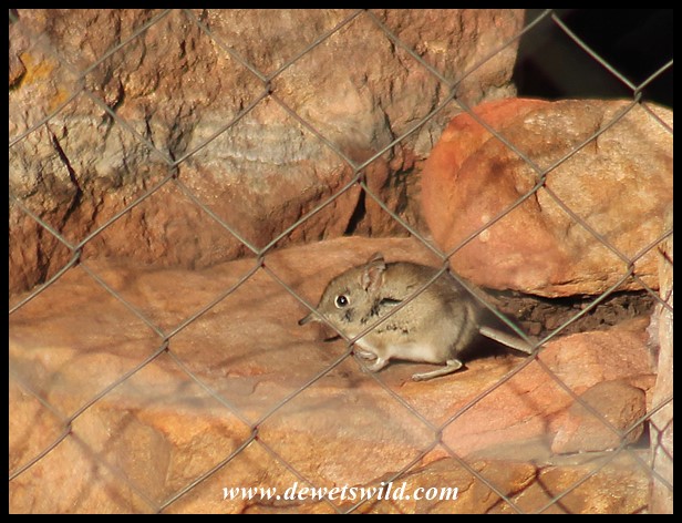
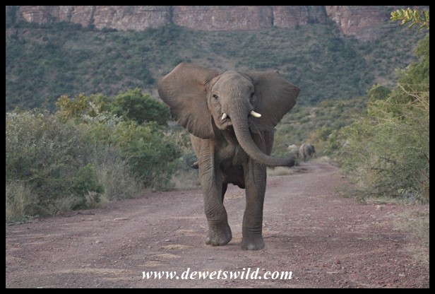
Mapunbuwe is home to a rich variety of wildlife, with records indicating a tally of 34 fish species, as many as 36 kinds of frogs, up to 75 species of reptiles, 460+ species of birds and 94 species of mammals, including the famed “Big 5“.
")
Kudus, wildebeest and zebras mingling in Mapungubwe National Park
")
Nile Monitor (photo by Joubert)
")
Southern African Tree Squirrel
")
Plains Zebras in Mapungubwe National Park (photo by Joubert)
")
Large-spotted Genet (photo by Joubert)
")
Fully grown elephant bull (photo by Joubert)
")
Mating pair of Lions
")
Pel’s Fishing Owl (photo by Joubert)
")
Lilac-breasted Roller (photo by Joubert)
")
Meves’s Starling
")
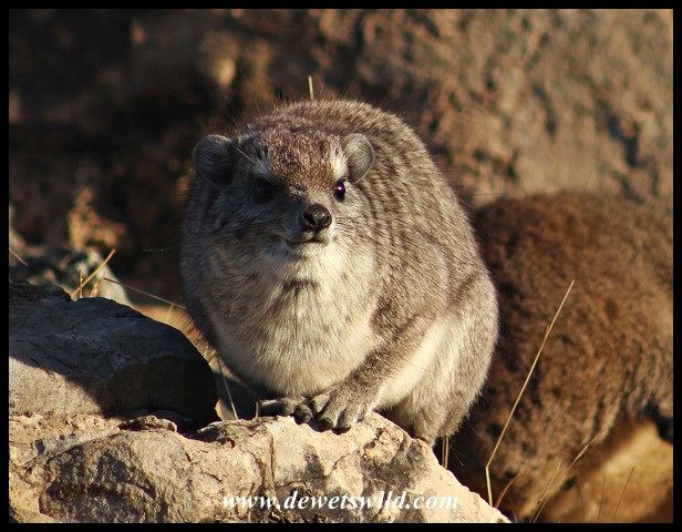
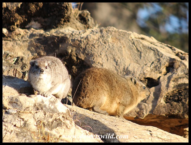
Yellow-spotted and Cape Rock Hyrax sharing the sun in Mapungubwe
")
Mocking Cliff Chat
")
Gemsbok
")
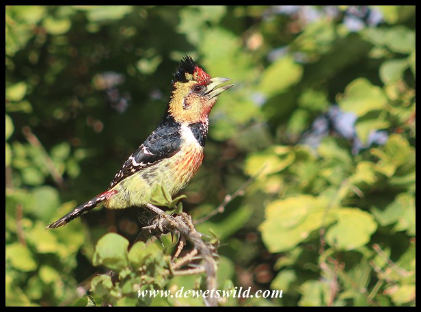
Crested Barbet (photo by Joubert)
")
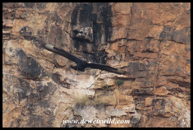
Lappet-faced Vulture (photo by Joubert)
")
White-fronted Bee-eater (photo by Joubert)
")
Steenbok ewe
")
Blue Wildebeest in Mapungubwe National Park
")
Warthog in Mapungubwe National Park
")
Kudu Bull
")
Rough-scaled Plated Lizard (photo by Joubert)
")
Newly born Giraffe calf with its mother
")
Eland bull in Mapungubwe National Park
")
Banded Mongoose
")
Baboons in Mapungubwe National Park (photo by Joubert)
")
Black Crake
")
Kudu Bull
")
Impala (photo by Joubert)
The South African National Parks provides an assortment of self-catering accommodation options in Mapunguwe National Park, ranging from camping sites at Mazhou in the riverine forest along the Limpopo River to the top-of-the-range Tshugulu Lodge. Remember that DeWetsWild can assist you with your reservations for a visit to Mapungubwe. Guided drives and walks, including visits to the Mapungubwe archeological site, can be booked at reception, while there are several gravel roads available for exploration in your own vehicle (even more if you have a 4×4). Simple meals and firewood is available from the interpretive centre, but the nearest available fuel, and other services, to the Park is in the towns of Alldays or Musina, both about 70km from the gate.
")
Cottage #18 in Leokwe Rest Camp, Mapungubwe National Park, June 2022
")
View from Cottage #18 in Leokwe Rest Camp
")
Leokwe’s swimming pool
")
Leokwe Rest Camp
")
Limpopo Forest Tented Camp
")
Mazhou Camping Area

Vhembe Wilderness Camp

Tshugulu Lodge

Tshugulu Lodge
Mapungubwe National Park and World Heritage Site lies right at South Africa’s northernmost corner, roughly 470km north of our capital Pretoria.

Location of Mapungubwe National Park (Google Maps)

")
")
")
")
")
")
")
")
")
")
")
")
")
")
")
")
")
")
")
")
")
")
")
")
")
")
")
")
")
")
")
")
")
")
")
")
")
")
")
")
")
")
")
")
")
")
")
")
")
")


")
")
")
")
")
")
")
")
")
")
")
")
")
")
")
")
")

")


")
")
")
")
")
")
")
")
")
")
")
")
")
")
")
")
")
")
")
")
")
")
")
")

")
")
")
")
")
")
")
")
")
")
")
")
")
")
")
")
")
")
")
")
")
")
")
")
")
")
")

")
")
")
")
")
")
")
")
")
")
")
")
")
")
")
")
")
")
")
")
")
")
")
")
")
")
")
")
")
")
")
")
")
")
")
")
")
")
")
")
")
")
")
")
")
")
")
")
")
")
")
")
")
")
")
")
")
")
")
")
")
")
")
")
")
")
")
")
")
")
")
")
")
")
")
")
")
")
")
")
")
")
")
")
")
")
")
")
")
")
")
")
")
")
")
")
")
")
")
")
")
")
")
")
")
")
")
")
")
")
")
")
