Tag Archives: travel

Lower Sabie Rest Camp, Kruger National Park

Lower Sabie must be the most popular destination in the Kruger National Park. It is exceedingly hard to get a booking here if you don’t book a year in advance. In peak season, even just finding parking to visit the shop or restaurant can be a challenge, as visitors from all over the the southern sections of the Park flock to the camp. The camp’s location on the banks of the Sabie River, in an area of exceptionally high-quality grazing in the south-eastern corner of the Park, ensures that its surrounds is frequented by an astounding variety and number of herbivores and their attending predators, making for game-viewing heaven!
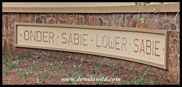
Lower Sabie (22)

The Sabie River got its name from the Shangaan word “saba” meaning fear, probably due to the large number of enormous crocodiles that call the river home. The dam in front of the camp came about after the causeway across the river was built in 1987 (it had to be rebuilt higher after the floods in February 2000).

The first tourist accommodation at Lower Sabie was a 5-bedroom house converted from ranger Tom Duke’s quarters in 1930, but this was demolished again just two years later after becoming dilapidated. The only access to Lower Sabie was via Gomondwane from Crocodile Bridge until the road from Skukuza reached it in 1931. The next attempt at providing guest accommodation at Lower Sabie then commenced in 1936, when three buildings, built in a u-shape and each housing six bedrooms, were erected – these units are still used as accommodation to this day, but has been extensively renovated since. Over the years, more accommodation and a camping site was added to the camp, leading up to an extensive project to revamp and enlarge Lower Sabie in the early 2000’s. Today the camp provides overnight accommodation in 117 huts, bungalows, cottages and safari tents and has space for 34 caravans and tents in its camping area. Lower Sabie’s restaurant (Mugg & Bean), with its deck overlooking the Sabie River, is especially popular. The camp has a well stocked shop for groceries and curios, a fuel station, swimming pool for overnight guests and a day visitors picnic area near the gate. Along the river, in front of the bungalows south of the restaurant, lush lawns and deep shade provided by enormous trees is just the place to spend a lazy afternoon, surrounded by Lower Sabie’s prolific birdlife.

We can certainly recommend joining at least one of the guided activities on offer from Lower Sabie, as excellent sightings are almost guaranteed.

Sunset Dam is a brilliant spot just a kilometer from Lower Sabie, and as its name suggests is very popular with visitors whiling away the last minutes before they have to get back to camp in the evening. You can park your vehicle right on the water’s edge, allowing excellent photographic opportunities of hippos, crocodiles, wading birds and herds of game coming to quench their thirst.

Heading north from Lower Sabie along the H10 tarred route to Tshokwane, you’ll encounter the first highlight of this route just minutes after leaving camp. The causeway across the Sabie River is a favourite spot for many visitors, who flock here to enjoy glorious sunsets and an abundance of game and bird species attracted to the water. The plains between Lower Sabie and Tshokwane is home to incredible herds of zebra and wildebeest at the end of winter, and is also an excellent place to look for reedbuck, one of the rarer antelope that occurs in Kruger. Of course, with so many herbivores roaming around it stands to reason that the predators are not far behind. If you, like us, enjoy your game viewing with as little other traffic as possible, try the gravel S29, S122 and S128 loops that turn off the main road as alternatives to explore this area. Two other beautiful places not to be missed is Mlondozi Picnic Spot, overlooking a large dam from Muntshe mountain, and Nkumbe Viewpoint, which offers an exceptional view over the open plains of Kruger.

The tarred H4-2 Gomondwane Road leading south to Crocodile Bridge is another very productive route for game viewing, though we personally prefer taking the gravel loops running roughly parallel to the main road (S28 Nhlowa Road, S82 Mativuhlungu Loop, S130 Gomondwane Loop and S137 past Duke’s waterhole) as these carry a little less vehicle traffic.

The H4-1 road between Lower Sabie and Skukuza carries more traffic than any other road in Kruger, and not without reason. There’s an excellent chance of seeing all the “big 5” game animals and so much more along this route, which follows the course of the Sabie River, on just one drive. The vegetation along the portion of this road nearer Lower Sabie is much more open than the stretch between Nkuhlu and Skukuza, making for even better game viewing. Keep your eyes open for lions and leopards at the rocks at the Lubyelubye stream crossing about 5km from Lower Sabie, as this is one of their most reliable haunts. Also, don’t miss the short S79 gravel loop that crosses the Nwatimhiri causeway, which is another favourite spot for feline predators. Nkuhlu Picnic Spot is a great place to get out, stretch the legs and have a bite to eat (though beware the monkeys and baboons that hang around here, as they will attempt to steal your picnic if they get even the slightest chance!). The gravel S30 Salitje Road along the northern bank of the river is a wonderful alternative route back to Lower Sabie.

If all these photos did not convince you, allow us to reiterate: Lower Sabie IS game-viewing heaven! Remember to book early if you also want to enjoy all it has to offer.

Exploring Marakele

A “Place of Sanctuary”; that Marakele National Park certainly is. As its Tswana name suggests, this Park of around 650km² in size offers protection not only to some of the most awe-inspiring scenery one could hope to find, but also to an impressive variety of fauna and flora. Humans too can find a safe and peaceful haven here in the malaria-free Waterberg range, as we were reminded again on our recent visit.

A public road splits Marakele into two sections. Kwaggasvlakte in the south-western corner is much smaller than the main portion of the Park lying to the east. Kwaggasvlakte is where the Park’s entrance gate and Bontle  Camp is located, and is characterised by flat, sandy plains on which mixed bushveld is the main vegetation type.

Overlooking a waterhole in the northern corner of the Kwaggasvlakte section, Bollonoto Hide offers a great place from which to enjoy the constant stream of game and birdlife arriving to quench their thirst.

A subway connects Kwaggasvlakte to the bigger, eastern portion of the Park. It is in this more mountainous section of the Park where elephants, buffaloes and lions also occur, just some of the 91 species of mammals that the Park hosts. Tlopi Tented Camp is available to guests who’d like to overnight in this section of the Park, which is dominated by a wholly different type of vegetation, described as “Waterberg Moist Bushveld”. A good network of roads allows visitors to explore widely – some of Marakele’s roads are only accessible to 4×4 vehicles, but most of the Park’s 80km road network can easily and comfortably be traversed in a sedan.

A very narrow tarred pass leads to Marakele’s most impressive attraction, the Lenong View Point on top of the Waterberg massif. Lenong lies at an altitude of 2050m, over a kilometer higher than Bontle on the Kwaggasvlakte below – a fact you become well aware of when your ears pop on the very steep and winding ascent. From the viewpoint you normally have fantastic views over the plains below and the mountains around, and perhaps get a close-up glimpse at Marakele’s prized colony of Cape Vultures soaring on the thermals. Unfortunately the weather didn’t play along when we went up to Lenong on our latest visit, the top of the mountain being cloaked in a thick and teeth-chatteringly cold fog. However, dipping below the clouds on our way down we did get glimpses of the wonderful views to be had from up there.

Our latest visit to Marakele was just 3 nights long, and honestly we found that too short to fully savour all the Park had to offer. The broken terrain does make game-viewing a little more challenging than in many other parks and reserves, especially if you are mostly after the “Big 5” (which we luckily aren’t, we just enjoy being “out there” and enjoy anything we find along the way), but as far as spectacular scenery and serenity is concerned Marakele has few equals.

Marakele National Park is managed by South African National Parks, and the access gate is located just 12km outside the town of Thabazimbi, which offers most of the modern conveniences. Thabazimbi is easily accessed from Gauteng along the N1 and R516 via Bela-Bela or via the R511 through Brits.

Road to Marakele (2)

Marakele Monkey Business

This troop of vervet monkeys kept us thoroughly entertained on the last morning of our recent visit to Marakele National Park. While the adults just wanted to warm their old bones in the first rays of golden sunshine, the boisterous youngsters had a lot of pent up energy to get rid of!

Beautiful Bontle

It seems only fitting that we should start the report back on our recent visit to Marakele National Park at Bontle, the beautiful little bushveld campground set on the plains below the imposing Waterberg mountains, and that we called home during our three night stay.

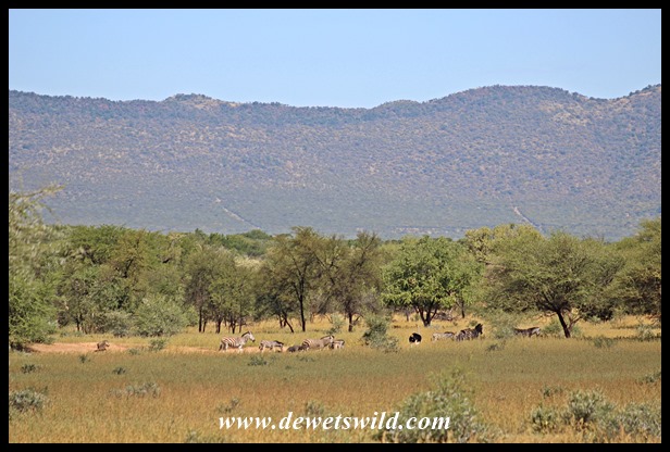
Bontle actually means “beautiful” in Setswana, and surveying the place from beneath a shady tree you can’t help but agree. Just outside the camp a waterhole attracts a constant stream of birds and animals, with a range of low hills to the south forming a beautiful backdrop to the scene.

View from Bontle

View from Bontle

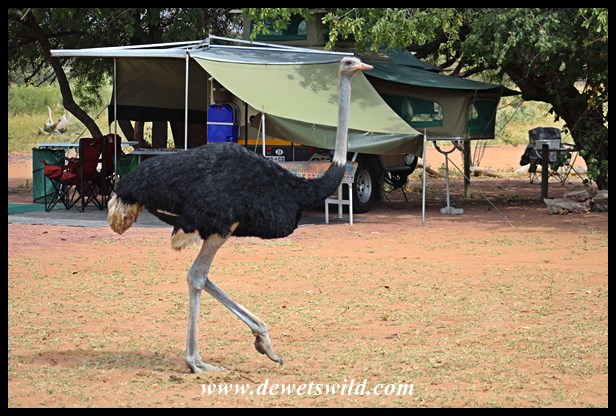
Wildlife has open access to Bontle, which is unfenced. While you don’t have to be concerned about being trampled by an elephant or eaten by a lion (these species occur elsewhere in Marakele, but not in the Kwaggasvlakte-section where Bontle’s located) you may well find yourself at close quarters with a variety of birds, various species of antelope, warthogs, zebras, giraffes, monkeys, baboons, bushbabies, springhares, jackals, ostriches and even white rhinos when you pop your head out your tent!

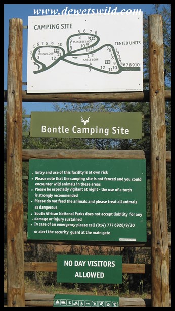
The campground accommodates 36 tents and caravans (all the campsites have electric plugpoints) around three communal ablution blocks (one of which is accessible to campers in wheelchairs). Ten safari tents are fairly recent additions to the offering at Bontle. Four of them sleep 4 guests each and the others 2 each. One of the two-bed tents have also been built with the needs of guests in wheelchairs in mind. The little kiosk at the entrance gate and reception office, about 1.5km from Bontle, conveniently stocks firewood, ice, sweets and cold drinks. Stock up on fuel and groceries in the nearby town of Thabazimbi.

This was our first stay at Bontle (managed by South African National Parks); on previous visits to Marakele we stayed at Tlopi Tented Camp in the bigger portion of the Park where the “Big-5” roam. But now that we’ve had a taste of Bontle’s beautiful tranquility it is hard to imagine that we’ll be able to resist the urge to return for very long.

Welcome to Bontle!

Welcome to Bontle!

More on Marakele in upcoming editions of de Wets Wild!


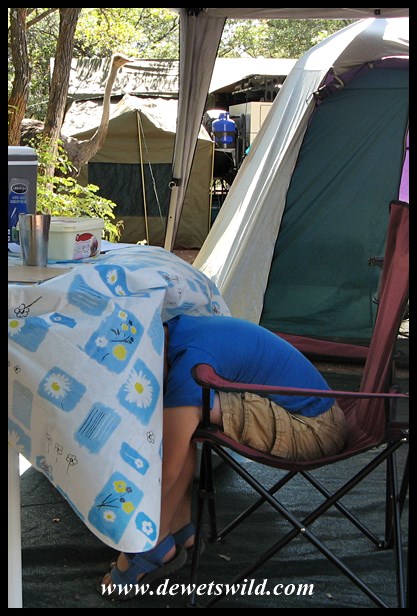
Hiding from an ostrich, like an ostrich…

Wildlife moves freely through the campsites at Bontle, in the Marakele National Park. Here Joubert demonstrates just how to hide from an inquisitive female ostrich…

Marakele_30Apr-2Mei2016 (2)

We’ve come to the end of our long weekend at Marakele, and will share some of this wonderful Park’s sights with you in upcoming editions of de Wets Wild – stay tuned!


Marakele breakaway

It is the Workers’ Day long weekend in South Africa, and we’re spending it camping at peaceful Bontle Camp in the Marakele National Park.

Marakele 29Apr2016

The fascinating world of Umlalazi’s Mangroves

No other kinds of tree are as well adapted to an existence in salty, tidal estuaries as the mangroves. Their roots are specifically adapted to not only anchor them in the muddy substrate but also allow them to “breathe” by sticking up above the mud and prevents the tree from drowning. Known as “pneumatophores”, these roots look different in the various genera of mangroves – those of the white mangrove (Avicennia marina) look like pencils sticking straight up out of the mud, the black mangrove (Bruguiera gymnorrhiza) has knee-like structures protruding before going back into the mud, and the red mangrove (Rhizophora mucronata) grow “struts” straight from the trunk. They have to contend with excessive salt in their tissues, and concentrates this in old leaves that are continuously shed and replaced. Mangrove fruit are also very interesting; seeds germinate while still attached to the flower, and some, like the black and red mangroves, even grow a cigar-shaped “root”, or “hypocotyl”, that is designed to anchor the seed in the muddy substrate when it drops from the tree.

These adaptations of the mangroves benefit the entire ecosystem by trapping silt, stabilising the substrate, and feeding the food chain. Mangrove snails (Cerithidea decollata) cling to the trunks of the trees during high tide, safely out of reach of estuarine fish that move in with the tide. At low tide, they then descend to feed on the muddy surface. Crabs abound in the mangroves. Sesarma is a genus of land-based crab that digs holes up to 2m deep into the mud and avidly collects fallen leaves into their burrows. Fiddler crabs (Uca-species), known for the males having one enormous pincer which which they display to one another and to interested females, feed by rolling scoops of mud into balls in their mouths, with the discarded balls leaving tell-tale trails where the crab has moved. Mudskippers, those uniquely adapted amphibious fish that seem to be as at home out of the water as in it, must be among the most curious of the mangrove swamps’ denizens. Estuaries in general and mangrove stands in particular are extremely important refuges and nurseries for several kinds of fish and crustaceans, making their protection an economic imperative if fisheries are to be sustained into the future and highlighting the value of conserved areas like Umlalazi.

Many kinds of wading birds feed on the rich invertebrate fauna in a mangrove swamp, with the woolly-necked stork being the most obvious at Umlalazi. The reserve’s mangroves also forms an important winter habitat for the mangrove kingfisher. Mangrove swamps, with their dense stands of trees and muddy terrain, are difficult areas for large mammals, with the exception of monkeys, to utilise.

At Umlalazi, a boardwalk constructed through a mangrove swamp allows easy access to this fascinating world – if you have only a little bit of time to explore Umlalazi, this is undoubtedly where you should spend it!

On the banks of the lazy Mlalazi

The Mlalazi River is an excellent example of an estuary in good natural condition, and considered among the twenty most important in conservation terms in South Africa. It is also a focal point for many visitors to Umlalazi Nature Reserve, who come here to enjoy a variety of watersports, or just picnic on the banks (to the delight of the clever vervet monkeys who’ll quickly raid unprotected baskets!)

One of Umlalazi’s trails leads all the way from the parking area at the lagoon to the mouth of the Mlalazi River where it empties into the Indian Ocean. Hikers can then return along the same route, or along the beach – a total distance of 8 or so kilometers. Unfortunately when I attempted the trail on our recent stay about half-way to the mouth I encountered a washed-away stream crossing, probably following the good rainfall the week before we arrived. After the thought of hungry crocodiles eyeing me from somewhere unseen crossed my mind, there was no way I was going to try and wade through a muddy backwater, and unfortunately had to turn around. Oh well, next time we’re at Umlalazi I will give it another go (the trail I mean, I’ll still refuse to wade through a muddy backwater if the bridge isnt fixed by then…)

Wandering around Umlalazi’s forests

A visit to Umlalazi Nature Reserve would not be complete without exploring the extensive tracts of pristine forests protected in the reserve.

Umlalazi’s Siyaya Trail snakes through the forest, up and down over the densely vegetated dunes, for a distance of 3km. Enormous red and smaller white milkwoods (Mimusops obovata and Sideroxylon inerme respectively) predominate in the species-rich climax dune forests. The Siyaya Trail starts at the beach parking area and makes a large circle through the forest to end at the parking area again, but about half-way through a side-trail leads to a footbridge over the Siyayi stream and to the beach.

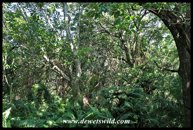
At the grove of Kosi palms (Raphia australis) a boardwalk has been constructed just above the level of the waterlogged forest floor, allowing easy access to these magnificent trees and the palm-nut vultures that feed and breed in them. Interestingly, the Kosi palms flower and fruit only once in their lifetime, when the tree is around 30 years old. Elsewhere in the swamp forests, a little further inland than the dune forest, ferns and the swamp fig (Ficus trichopoda) are the most noticeable species.

Umlalazi’s forests abound with insects and other invertebrates, numerous insectivorous and frugivorous forest birds, as well as forest dwelling mammals, of which the red duikers and vervet monkeys are the easiest to see.

A beach that goes on and on at Umlalazi

Whether you’re a sun worshipper, an adrenaline junky, a sports nut or just looking for a quiet position from where to contemplate your place in the world, the beach at Umlalazi definitely has a spot where you can enjoy the Indian Ocean just the way you like it.