29 December 2020
The first leg of our route through the Addo Elephant Park this morning, again managing to leave camp as the gates opened, went past Gwarrie Pan and Rooidam towards Hapoor Dam. Still being early in the morning there was little animal activity around the watering holes but lots to see along the way nevertheless, both big and small.
")
Bush Karoo Rat
")
Warthog
")
Elephant cow and calf
It was on arrival at Hapoor Dam that the morning turned really exciting as we came across spotted hyenas feeding on the carcass of a buffalo calf, soon to have their feast interrupted by a very annoyed elephant bull. More on that tomorrow!

Annoyed elephant spoiling the hyena feast
I think by now the birds inhabiting Jack’s Picnic Spot started to recognise us as friends, for they were very eager to join us at our breakfast table and didn’t let any rusk crumbs that dared drop to the ground go unpunished!
")
Southern Boubou
")
Cape Robin-Chat
")
Terrestrial Brownbul
")
Bar-throated Apalis
From “Jack’s” we headed south-east as far as Arizona Dam before turning back to camp along the same way we came, just in case there was still some drama at Hapoor (which there was, but this time it involved elephants waiting for a work crew to fix an errant water pump so they could get their morning drink).
")
Another cute elephant calf
")
Scrub Hare
")
Jackal Buzzard
")
Elephants waiting at Hapoor Dam for the humans to finish fixing a pump
")
Angulate Tortoise
")
Red Hartebeest (photo by Joubert)
")
Red Hartebeest
")
Malachite Sunbird with Pig’s Ear flowers
From the moment we left camp for our afternoon drive it was noticeable that there was a sudden explosion in the Park’s Warthog population, as seemingly every sow we saw was accompanied by little bundles of joy – not something we noticed on any of our previous drives.
")
Warthog piglets with their mom
")
Warthog piglets with their mom
")
Warthog piglets with their moms
")
Warthog piglets
")
Warthog piglet
")
Warthog piglets
")
Warthog boar
Another notable encounter in the afternoon, which by then turned exceedingly windy, was with a family of foraging Meerkats, a perennial favourite with visitors to our parks.
")
Meerkat sentry
")
Meerkat sentry
")
Meerkats foraging
")
Meerkat sentry
")
Meerkats searching for food
But warthogs and meerkats weren’t all that we crossed our path that afternoon and we returned to camp very pleased with our day – again!
")
Karoo Boer-bean flowers
")
Elephant drinking at Spekboom waterhole
")
Leopard Tortoises are commonly encountered in Addo
")
Curious young kudu bull
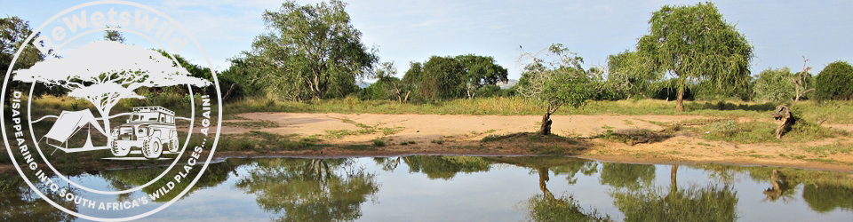
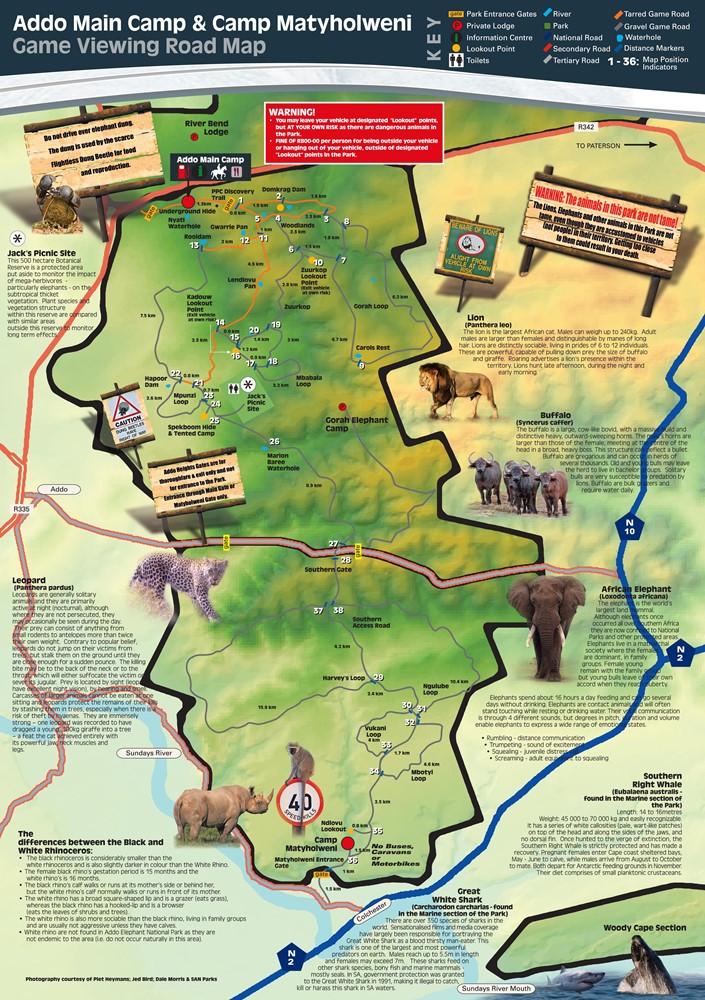
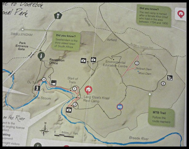
If you’d like to learn more about the Addo Elephant National Park’s history and all it has to offer visitors, why not have a read through this post we compiled after our previous visit? And to follow along on our travels through Addo, you might find this map (from the SANParks website) most handy. Addo map from https://www.sanparks.org/parks/addo/tourism/map.php
-33.483429
25.750580
")
")
")
")
")
")
")
")
")
")
")
")
")
")
")
")
")
")
")
")
")
")
")
")
")
")
")
")
")
")
")
")
")
")
")

")
")
")
")
")
")
")
")
")
")
")
")
")
")
")
")
")
")
")
")
")
")
")
")
")
")
")
")
")


")
")
")
")
")
")
")
")
")
")
")
")
")
")
")
")
")
")
")
")
")
")
")
")
")
")
")
")
")
")
")
")
")
")
")
")
")
")
")
")
")
")
")
")
")
")
")
")
")
")
")
")
")
")
")
")
")
")
")
")
")
")
")
")
")
")
")
")
")
")
")
")
")
")
")
")
")
")
")
")
")
")
")
")

")
")
")
")
")
")
")
")
")
")
")
")
")
")
")
")
")
")
")
")
")
")
")
")
")
")
")
")
")
")
")
")
")
")
")
")
")
")
")
")
")
")
")
")
")
")
")
")
")
")
")
")
")
")
")
")
")
")
")
")
")

")
")
")
")
")
")
")
")
")
")
")
")
")


")
")
")
")
")
")
")
")
")
")
")
")
")
")
")
")
")
")
")
")
")
")
")
")
")
")
")
")
")
")
")
")
")
")
")
")
")
")
")
")
")
")
")
")
")
")
")
")
")
")
")
")
")
")
")
")
")
")
")
")
")
")
")
")
")
")
")
")
")
")
")
")
")
")
_Bontebok_20Dec2020 (3)")
")
")
")
")
")
")
")
")
