Kruger’s capital, and monument to a conservation stalwart.
Today, Skukuza Rest Camp is the biggest and busiest tourist facility in the Kruger National Park, the Park’s administrative headquarters and a world-leading centre of scientific research in the field of nature conservation. The rest camp has a long and rich history dating back more than a 100 years and it shares much of this history with one man, to whom more than any other should go the credit for the establishment of this world renowned Park.
At the end of the South African War, Major (later Colonel) James Stevenson-Hamilton was appointed to the position of warden of the Sabie Game Reserve; a loosely defined piece of land between the Sabie River in the North, the Crocodile River in the South, the foothills of the Drakensberg in the West and the Lebombo Mountains in the East that was proclaimed a game sanctuary by president Paul Kruger of the (then still independent) Zuid-Afrikaansche Republiek, some months before hostilities broke out with the British.
Stevenson-Hamilton, born in October 1867, arrived at his new station in July of 1902, soon setting up his office at Sabie Bridge, the place where the Selati Railway crossed the Sabie River. It was the local Shangaan population that gave Stevenson-Hamilton his nickname of “Skukuza“, meaning “he who sweeps clean” or “he who turns everything upside down“. Against considerable odds, piled up against him from politicians, mining houses and wealthy landowners, the plucky Scotsman managed to considerably enlarge the area under his jurisdiction, expand his powers of law enforcement, and won considerable support from the South African public, culminating in the proclamation of the Kruger National Park by Minister of Lands, Piet Grobler, on the 31st of May 1926.
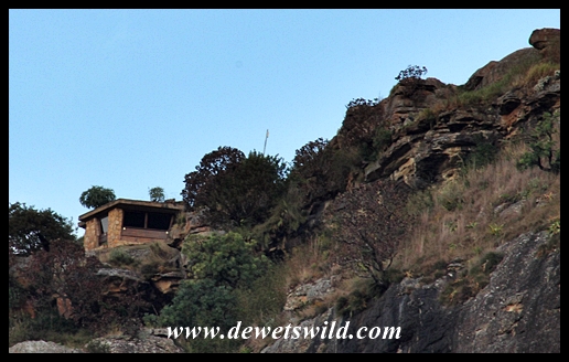
The Kruger National Park was opened to the public in 1927, and by 1929 the first purpose-built accommodation facilities at Sabie Bridge, or “Reserve” as it became known, housed their first guests. The first hut, named the “Campbell Hut” after W.A. Campbell, a founding member of the National Parks Board, has been preserved as a tiny museum showcasing the early years of tourism in the Kruger Park, and is located near Skukuza’s restaurant. In those early years, visitors could enjoy (or dread) crossing the Sabie on a rickety pontoon, which was only replaced by a low-level causeway (still in use today) in 1937.

Campbell Museum Hut
In 1936, the camp at Sabie Bridge / Reserve was renamed to Skukuza, in honour of Colonel Stevenson-Hamilton, then still firmly at the helm of the National Park he referred to as a “Cinderella” in his memoirs “South African Eden”. Stevenson-Hamilton retired from the position of Warden in April of 1946, at the age of 78 and after 44 years of dedicated service, leaving an enduring legacy enjoyed by millions of people from all over the world to this day. He passed away on the 10th of December 1957, aged 90. After the death of his wife Hilda, the couple’s ashes were strewn over the boulders at Shirimantanga, to the south of Skukuza at a place Stevenson-Hamilton chose himself, in April 1979. Today, Shirimantanga is a popular, if sombre, place to visit for many of the Kruger faithful.
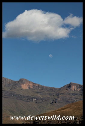
Shirimantanga Hill, final resting place of James and Hilda Stevenson-Hamilton
The view from Shirimantanga
Stevenson-Hamilton would probably not recognise much of the modern Skukuza, the view of the majestic railway bridge over the Sabie probably being all that will seem familiar from his first years in the Reserve. In addition to a dormitory that can house dozens of learners and their teachers on educational visits to the Kruger Park, Skukuza can accommodate 745 guests in 240 accommodation units, as well as over 500 campers making use of their own tents or caravans. The camp has most of the facilities you’d expect to find in a medium-sized town, and then some. It is the scene for the annual Skukuza Half Marathon, one of the country’s most popular running events. Skukuza’s airport receives several daily flights to and from Johannesburg and Cape Town. The camp has a doctor, police station, church, shop, two restaurants, fuel station and vehicle repair facilities, a golf course with a club house serving light refreshments, a dedicated day visitors area (complete with picnic sites, swimming pool and kiosk), a primary school for staff children, and a nursery where indigenous plants are propagated and sold to visitors. The impressive main building, opened in 1989, houses the reception and reservation offices, car hire company, bank and post office, and many a family portrait has been taken in front of the sculpted faces of the Kruger Park’s “founding fathers” that adorn one side of the building.
")
Sunset view of the Sabie Bridge from Skukuza’s day visitors area

The view of the Sabie Bridge from Skukuza’s promenade

Steam engine at Skukuza “station”

Skukuza shop
")
Skukuza reception
")
Skukuza reception
")
Skukuza reception
")
The fathers of the Kruger National Park: On the left, Minister Piet Grobler, in the centre President Paul Kruger, and on the right, Colonel James Stevenson-Hamilton
")
Wetland walkway at Skukuza Nursery
")
Skukuza Nursery
")
Wetland walkway at Skukuza Nursery
")
Skukuza Nursery

Skukuza golfcourse
")
Squirrel at Skukuza Day Visitors Area
")
Skukuza Day Visitors Area

Skukuza Camping
")
Skukuza Airport
")
Skukuza Airport
")
Skukuza Airport
")
Skukuza Accommodation
")
Nyathi Guest House
")
Skukuza accommodation
")
Riverside bungalow
")
Family cottage
")
Bungalow 210 – our favourite hut in Skukuza

Conquered victor
The Nombolo Mdhluli Conference Centre is a state-of-the-art facility, named in honour of a man who joined Stevenson-Hamilton staff as a field ranger in 1919, only retiring 52 years later in 1971 and widely acknowledged as a treasure trove of information about Kruger’s formative years. The Kruger National Park Museum is housed in the Stevenson-Hamilton Memorial Library, built in 1961, and showcases many fascinating Kruger memorabilia, including the skin of the lion that attempted to kill Ranger Harry Wolhuter. The statue of Stevenson-Hamilton at the entrance was sculpted by his very artistic wife, Hilda. At the back of the library building stands another well-known Skukuza landmark, the clocktower erected in honour of H.B. Papenfuss, a staunch campaigner for the proclamation of the Kruger Park and also a founding member of the National Parks Board. Near the museum’s entrance the “Little Heroes Acre” is a collection of grave stones commemorating many of the dogs that faithfully served with several of the Kruger Park’s game rangers over the years.

Papenfuss clocktower

Nombolo Mdhluli Conference Centre
")
Little Heroes’ Acre
")
Little Heroes’ Acre
")
Stevenson-Hamilton Memorial Library & Kruger National Park Museum

Stevenson-Hamilton Memorial Library & Kruger National Park Museum

Stevenson-Hamilton Memorial Library & Kruger National Park Museum

Stevenson-Hamilton Memorial Library & Kruger National Park Museum
As far as roads are concerned, it may seem that all roads in Kruger lead to Skukuza. The entire area around the camp is a game-viewers heaven (it is often mentioned that Skukuza has the highest density of leopard anywhere in Africa, and we’d certainly agree), and they are spoiled for choice when it comes to the routes radiating from the camp.
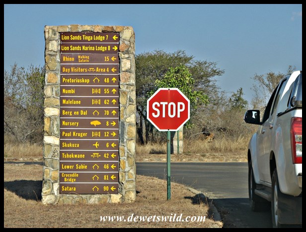
Road signpost at Skukuza
Heading northwards, the H1-2 route crosses first the Sabie and then the Sand Rivers, heading for Tshokwane Picnic Site and Satara Rest Camp (or Orpen Rest Camp, along the S36-gravel road), with the rest of the Kruger National Park lying beyond. Along the way, dont miss the chance to explore the Maroela Loop, where I had probably my best leopard sighting ever!

Sabie Bridge seen from the causeway over the river

Crocodiles in the Sabie River

Hippos in the Sabie River

White rhinoceros
")
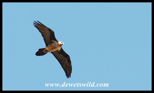
Yellow-billed hornbill at Tshokwane

Mating pair of lions on the road to Tshokwane

Tshokwane Picnic Spot

Leopard on the Maroela Loop, near Skukuza in the Kruger Park
The H4-1 road to Nkuhlu Picnic Site and Lower Sabie Rest Camp to the south-east of Skukuza, following the course of the Sabie River, is by far the most popular route in the entire Park (it’s along this stretch of road that we enjoyed our marvelous sighting of a large pride of lions during our August 2014 visit to Skukuza).

Nkuhlu Picnic Site

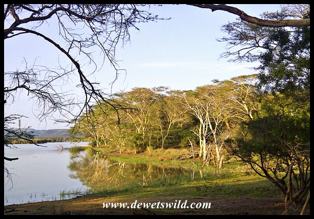
View over the Sabie River

View over the Sabie River

Young male lion along the Sabie River road

Sunrise giraffe

Marabou roost near Skukuza

Waterbuck

Bushbuck are very common along the Sabie
")
Tubby crossing the Salitje Road (S30)

View over the Sabie River
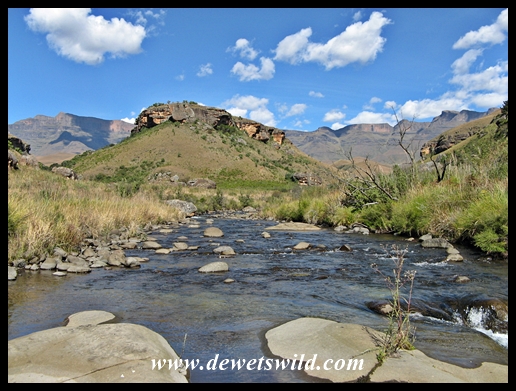
Towards the west, the roads head in the direction of three popular entrance gates into the southern Kruger Park, all allowing easy access to Skukuza. The H11 to Kruger Gate offers a worthwile deviation to the photographic hide at Lake Panic, the S1-tar road and S3-gravel roads lead to Phabeni Gate, and the H1-1 leads to Pretoriuskop Rest Camp and Numbi Gate nearby, past the well frequented (by humans and wildlife alike) Transport and Shitlhave Dams and the grand granite view point at Mathekenyane.

Rangers Monument at Kruger Gate

Rangers Monument at Kruger Gate

Kruger Gate
")
Kruger Gate

Statue of Paul Kruger at Kruger Gate

Statue of Paul Kruger at Kruger Gate
")
Kruger Gate
")
Lake Panic
")
Lake Panic
")
Lake Panic
")
The view from atop Mathekenyane Hill
")
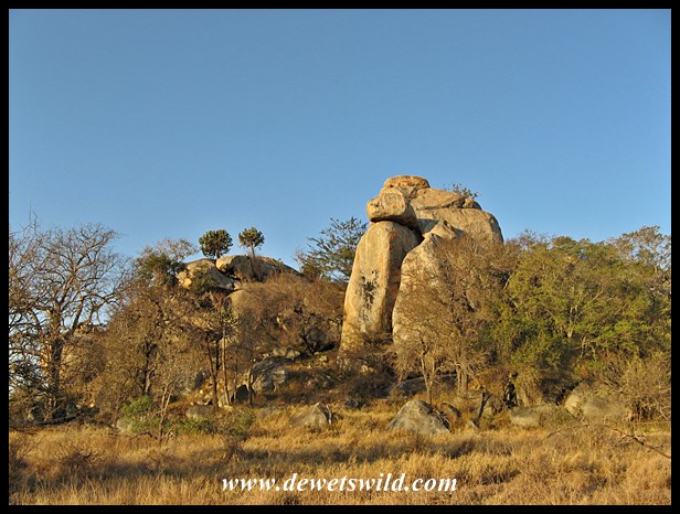
Mathekenyane is a huge granite boulder
")
De La Porte waterhole
")
Elephant crossing the Napi Road (H1-1)
")
Klipspringer are commonly seen on the hills along the H1-1

Sleepy lions on the H1-1

Hyenas on the S65 (Kruger Park)
")
Phabeni sunset
")
Phabeni Gate
")
Leopard on the S3
")
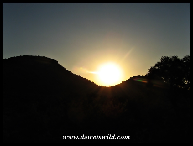
Skukuza sunrise
")
Leopard in a tree on the S3 near Skukuza, Kruger Park
Finally, the H3-tar and S114 gravel roads, both with several interesting side loops (to Shirimantanga for example), take visitors to Afsaal Picnic Spot and the mountainous terrain around Berg-en-Dal Rest Camp and Malelane Gate.
")
Lilac-breasted Roller on the H3
")
The south of Kruger is a stonghold of the white rhino

Unusual breakfast guests at Afsaal Picnic Spot

Elephant on the H3
To many people, Skukuza is simply too big and too busy to provide the escape “away from it all” they come to seek in the Kruger National Park. During the day, when the camp is positively vibrant with visitors from all over the world enjoying the excellent amenities and calming view over the Sabie River flowing in front of the camp, that may well be true. We’ve always found however that when dusk settles over Skukuza at gate closing time, so does the peace and serenity that’s become synonymous with Stevenson-Hamilton’s “South African Eden“…
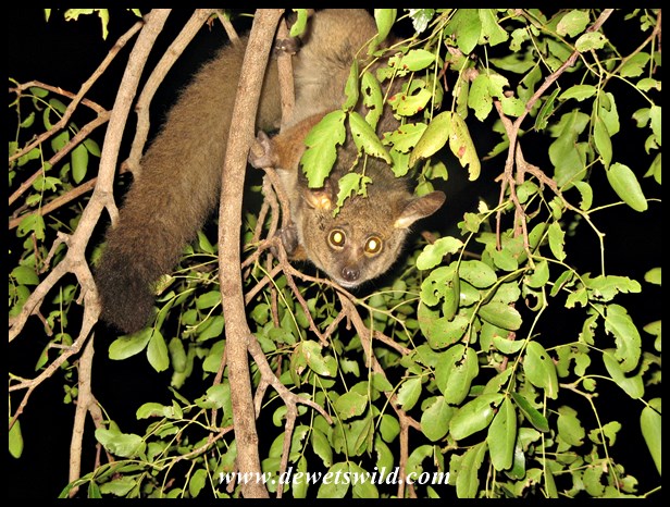
At night, Skukuza’s bushbabies come out to play
-24.995833
31.591944

")
")
")
")
")
")
")
")
")
")
")
")
")
")
")
")


")
")
")
")
")
")
")
")
")
")
")
")
")
")
")
")
")
")
")
")
")
")
")
")
")
")
")
")
")
")
")
")
")
")
")
")
")
")
")
")
")


")
")
")
")
")
")
")
")

")
")
")
")
")
")
")
")
")
")
")
")
")
")
")
")
")
")
")
")
")
")
")
")
")
")
")
")
")
")
")
")
")
")
")
")
")


")
")


")
")

")
")


")
")


")
")


")
")


")
")


")
")
")
")
")
")
")
")
")
")
")
")
")
")
")
")
")
")
")
")
")
")
")

")
")
")
")
")
")
")
")
")
")
")
")
")
")
")
")
")
")
")
")
")
")
")
")