
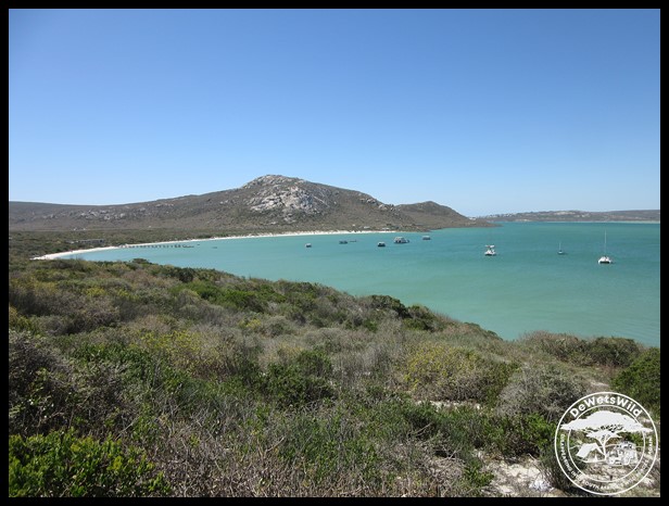
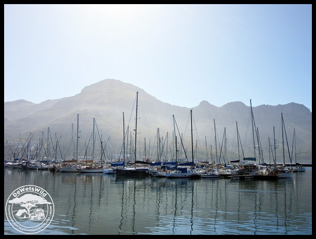
Saldanha Bay and the Langebaan Lagoon on South Africa’s West Coast was formed as few as 9,000 years ago when the Atlantic Ocean breached the barrier dunes along the coast. Langebaan Lagoon – 15km long, between 1 and 4km wide and up to 6m deep – is still marine in nature, not receiving any fresh water from inflowing rivers, and subject to the oceanic tides. The lagoon with its crystal clear water is renowned as a refuge for wading birds, many of which migrate here in our summer months – with more than 70,000 counted at times! – and a staggering array of marine life, and was proclaimed a marine nature reserve in 1973. It attained the status of a national park in 1985 and, following the incorporation of more land adjacent to the lagoon from 1987 onwards the name was changed from Langebaan National Park to West Coast National Park in 1988. In the same year the Park was given recognition as a wetland of international importance in terms of the Ramsar convention.
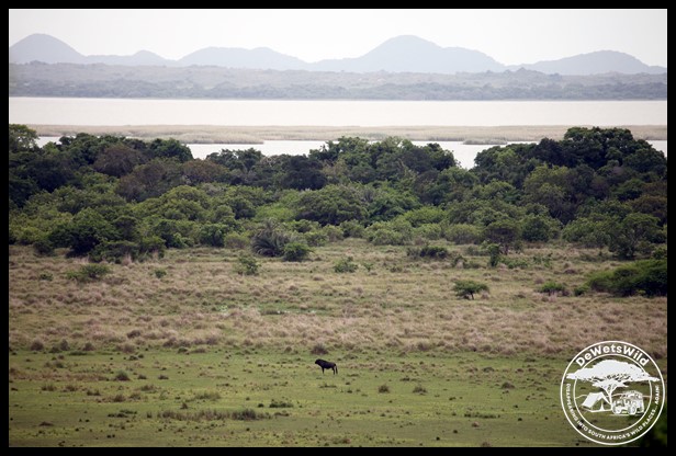
Today, the Park covers 400km² of which the lagoon accounts for 56km². Aside from the 30km of pristine Atlantic coastline (known as Sixteen Mile Beach) and a few offshore islands the rest is undulating sandy terrain broken by a few limestone and granite outcrops and covered by a rich variety of Fynbos vegetation communities and South Africa’s most extensive salt marshes. All this is inhabited by at least 54 land mammal species, over 300 bird species, more than 30 kinds of reptiles and 8 kinds of amphibians, not to mention the several hundred species of marine creatures. The Park is a stronghold for the Black Harrier (an endangered species) and African Oystercatcher and hosts the largest breeding colony of Kelp Gull in South Africa. Most of the Park’s preciously little 280mm average annual rainfall occurs in winter, when daytime temperatures average 19ºC. In summer, temperatures may soar above 40ºC but averages around 28ºC.
")
Angulate Tortoise
")
Male Southern Black Korhaan
")
Cape Spurfowl
")
White-backed Mousebird
")
Cape Spurfowl
")
Grey-winged Francolin
")
Black Harrier (photo by Joubert)
")
Ostrich pair
")
Sea Lavender (Limonium species)
")
White-throated Canary
")
Steppe, or Common, Buzzard
")
Steenbok
")
Female Yellow Canary
")
Black-winged Kite
")
Wattled Starling
")
Eland
")
Ostrich pair
")
Common Starlings
")
Steenbok
")
Bontebok
")
Ostrich male
")
A view of iconic Table Mountain all the way from the West Coast National Park
The Park’s focal point is the Geelbek Manor, a restored farmhouse in Cape Dutch style complete with its outbuildings that date back to 1860. The farm was settled much longer before then though and around the 1750’s was the northernmost point of Dutch influence under the Dutch East India Company’s occupation of the Cape of Good Hope, marked to this day by the VOC logo on a stone beacon erected by their representatives that can be seen at Geelbek. The homestead now houses a top-notch restaurant, while the stables have been converted into a dormitory and educational facility for visiting school groups. A replica of a set of fossilized footprints found in the area, dated to 117,000 years ago and dubbed “Eve’s footprints”, can be seen in the small information centre next to the restaurant (the original footprints are to be seen in the National Museum in Cape Town).
")
The VOC (Dutch East India Company) marker near Geelbek
")
Sunrise at Geelbek in the West Coast National Park
")
Geelbek Manor
")
The historic Geelbek Manor, now a restaurant
")
The historic Geelbek Manor, now a restaurant
")
Sunset at Geelbek in the West Coast National Park

Geelbek’s stables have been converted to dormitories and educational facilities

Replica of “Eve’s Footprints” in the information centre at Geelbek
")
Barn Owl
")
Barn Swallow
")
Bontebok
")
Cape Hare
")
Cape Spurfowl (photo by Joubert)
")
Cape Weaver (photo by Joubert)
")
Clicking Stream Frog
")
Eland
")
Marbled Leaf-toed Gecko
")
Marbled Leaf-toed Gecko
")
Sunrise over the plain at Geelbek
")
Mole Snake (photo by Joubert)
")
Pied Crows
")
Rock Kestrel
")
Rock Kestrel
")
Rock Martin
")
African Sacred Ibis
")
Speckled Pigeon
")
Spider webs
The two birdwatching hides at Geelbek is rated among the best in the country, and with good reason. At low tide the mud flats in front of the hides attract thousands of wading birds after invertebrate prey, and the walk ways leading to both allow a closer view of the community of plants and invertebrates in the extensive salt marshes.
_WestCoast_Dec2022_DdW (31)")
The southern of the two hides at Geelbek
")
The northern of the two hides at Geelbek

Salt marsh in the West Coast National Park, dominated by Perennial Glasswort
")
Salt marsh in the West Coast National Park, dominated by Perennial Glasswort
")
Salt marsh in the West Coast National Park, dominated by Perennial Glasswort
")
Perennial Glasswort
")
African Oystercatcher
")
Kittlitz’s Plover
")
Lesser Flamingoes (photo by Joubert)
")
Shore Crab (photo by Joubert)
")
Greater Flamingo (photo by Joubert)
")
Sanderling
")
Kittlitz’s Plover
")
Common Whimbrel
")
The mud flats exposed at Geelbek on the low tide
")
Greater Flamingoes
")
Grey Plover
")
Kelp Gull
")
Greater Flamingoes
")
Cape Teal
")
Little Stint
")
Three-banded Plover
")
Female Southern Double-collared Sunbird
")
Flock of Ruddy Turnstones (photo by Joubert)
")
Congregation of hundreds of birds at Geelbek
")
Pied Avocets
")
Curlew Sandpipers
")
Egyptian Goose (photo by Joubert)
")
White-fronted Plover
")
Little Stint
")
Kittlitz’s Plover
")
Common Whimbrel
")
Little Egret
")
Greater Flamingo in flight
")
Greater Flamingo
")
Sanderling
")
Common Ringed Plover
")
Common Whimbrels
")
Common Greenshanks
")
Curlew Sandpiper
")
Wattled Starling
")
Kittlitz’s Plover
")
Greater Flamingoes
")
Pied Avocets
")
Common Ringed Plover
")
Grey Plover
Driving between the town of Langebaan and Geelbek visitors should not miss the turnoff to the Seeberg (Sea Mountain) viewpoint. From atop the massive granite boulder you can see almost every corner of the lagoon and most of the national park. In the little house built on the boulder – at one point actually inhabited – is a fascinating display on the history of the area.
")
Steenbok
")
Female Southern Black Korhaan
")
Karoo Scrub Robin
")
Seeberg viewpoint
")
The viewpoint and information room at Seeberg
")
The view from Seeberg towards Postberg on the opposite side of the Langebaan Lagoon
")
The view southwards from atop Seeberg
")
Rock Dassies (or Hyraxes)
")
Black Girdled Lizard
")
Common Starling (photo by Joubert)
")
Grey-winged Francolin
")
Steenbok
Below Seeberg, on the shores of the lagoon, is another bird-watching hide from where the multitude of waterbirds can be watched from close quarters.
")
Seeberg Hide looks like a ship at a distance
")
A portion of the view from the Seeberg Birdhide
")
Salt marsh in the West Coast National Park, dominated by Perennial Glasswort
")
Cape Fur Seal swimming in the Langebaan Lagoon
")
Curlew Sandpipers
")
Common Ringed Plovers
")
Caspian Tern
")
Kittlitz’s Plover
")
Immature Kittlitz’s Plover
")
White-fronted Plover
")
Medusa’s Head Euphorbia
")
Suspect this is a kind of Erica
")
White-throated Swallows
")
Seeberg seen from the hide of the same name
While there’s no shortage of salt water in the West Coast National Park, fresh water is a rare commodity. One of the few sources is the Abrahamskraal waterhole, where the excellent birdwatching hide allows visitors to see a whole different community of birds and animals.
")
The hide at Abrahamskraal waterhole in West Coast National Park
")
The Abrahamskraal waterhole in West Coast National Park
")
African Stonechat
")
African Swamphen
")
Black-winged Stilt
")
Cape Shoveler
")
Cape Teal
")
Common Greenshank
")
Eland
")
Kelp Gull (photo by Joubert)
")
Little Grebe
")
African Spoonbill
")
White-throated Swallow
")
Yellow-billed Ducks
")
Yellow-billed Duck
On the western shore of the lagoon is the beautiful beaches of Kraalbaai and Preekstoel, complete with white sand and yachts and houseboats bobbing on the crystal clear water.
")
Kraalbaai on the Langebaan Lagoon
")
The white beaches and clear water of the Langebaan Lagoon

The beach at Preekstoel

Preekstoel (Pulpit)

The beach at Preekstoel
")
a Hartlaub’s Gull in the crystal clear water of the Langebaan Lagoon
")
Cape Bulbul
")
Cape Bunting
")
Cape Robin-Chat
")
Karoo Prinia
")
Karoo Scrub Robin
")
Female Dusky Sunbird
Tsaarsbank is a rocky beach on the Atlantic Ocean that faces out towards Vondeling Island, which is jam-packed with a colony of Cape Fur Seals and a myriad of seabirds – they even make themselves at home inside and on top of the abandoned buildings dating back to the times when whaling was a major industry in Saldanha.
")
Atlantic Ocean at Tsaarsbank
")
Vondeling Island teems with seals and seabirds
")
Crowned Cormorant
")
Ruddy Turnstone
")
Kelp Gulls facing the waves
")
Shells accumulating on the beach at Tsaarsbank
")
Seashells on the seashore
")
Shells accumulating on the beach at Tsaarsbank
")
Mussel shells and a dead crab that was deposited on the beach at Tsaarsbank
")
Crowned Cormorants
")
Young Cape Fur Seal on the beach at Tsaarsbank
")
African Oystercatcher
")
Unidentified shrub at West Coast National Park
")
African Oystercatcher
")
A seal skull on the beach at Tsaarsbank
")
A mummified seal carcass on the beach at Tsaarsbank
")
Immature Kelp Gull
")
Hartlaub’s Gull
")
White-necked Raven
")
Exposed sand dunes at the back of Tsaarsbank
Unfortunately for us, the Postberg section of the Park is only open to visitors in August and September at the peak of the spring flower season, so we will have to return then to explore that area beyond the glimpses we had from the road leading to Tsaarsbank.

Bontebok grazing in the Postberg section of the West Coast National Park
During our visit to the West Coast National Park in December ’22 we stayed in the Van Breda Cottage just behind the Geelbek Manor. The historic cottage sleeps six people in three bedrooms, with a bathroom, fully equipped kitchen and spacious lounge. The wide stoep has a built-in braai and a lovely view towards the lagoon. Other accommodation options available in the Park include the Abrahamskraal Cottage, situated among the fynbos to the south of Geelbek, Jo-Anne’s Beach House, located beautifully with a view of the lagoon on the narrow spit of land between the lagoon and the ocean in the west of the Park, and the 2-bed Steytler Cottage at the Geelbek Manor. Remember that DeWetsWild can assist you with bookings if you are planning a visit to the West Coast National Park – either in the Park itself or at the Port Owen Marina in nearby Velddrif. Visitors to the Park can enjoy various adventure activities provided by operators in the surrounding towns, enjoy hiking or mountain bike trails, diving and swimming in the lagoon or at the beaches, or sightseeing along the excellent tar and gravel road network. Picnic sites with braai (South African barbeque) facilities are available at Tsaarsbank and Preekstoel.

Van Breda Cottage in the West Coast National Park, December 2022

Van Breda Cottage in the West Coast National Park, December 2022
")
Abrahamskraal Cottage

Steytler Cottage
While the West Coast National Park has no shop and only the one restaurant at Geelbek, the holiday town of Langebaan just outside the northern entrance gate into the Park has all the amenities visitors might require. The West Coast National Park is easily accessible from Cape Town, less than an hours drive away along the R27 highway.


")
")
")
")
")
")
")
")
")
")
")
")
")
")
")

")
")
")
")
")
")
")
")
")
")
")
")
")
")
")
")
")

")
")
")
")
")
")
")
")
")
")
")
")
")
")
")

")
")
")
")
")
")
")
")
")
")
")
")
")
")
")
")
")
")
")
")
")
")
")
")
")
")
")
")
")
")
")
")
")
")

")
")
")
")
")
")
")
")
")
")
")
")
")
")
")
")
")
")
")
")
")
")
")
")
")
")
")
")
")
")
")
")
")
")
")
")
")
")
")
")
")
")
")
")
")
")
")
")
")
")
")
")
")
")
")
")
")
")


")
")
")
")
")
")
")
")
")
")
")
")
")
")
")
")
")
")
")
")
")
")
")
")
")

")
")
")
")
")
")
")
")
")
")
")
")
")
")
")
")
")
")
")
")
")
")
")
")
")
")
")
")
")
")
")
")
")
")
")
")
")
")
")
")
")


")
")
")
")
")
")
")
")
")
")
")
")
")
")
")
")
")
")
")
")
")
")
")
")
")
")
")
")
")
")
")
")
")
")
")
")
")
")
")
")
")
")
")
")
")
")
")
")
")
")
")
")
")
")
")
")
")
")
")
")
")
")
