Tsitsikamma (Garden Route National Park)

When it was proclaimed in 1964, Tsitsikamma was the first marine national park in Africa. Since then it was progressively enlarged as more areas on land and sea was added to the Park, and by the time it was incorporated into the Garden Route National Park alongside Wilderness National Park, Knysna National Lake Area, and extensive tracts of state forests in between in 2009, the Tsitsikamma section covered an 80km stretch of coastline, extending on average 5km out to sea.

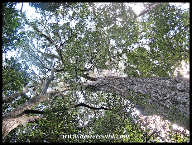
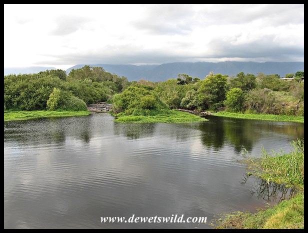
The name “Tsitsikamma” is a Khoekhoen word meaning “place of much water”, which is very apt as the region receives on average around 1,200mm of rain annually. This is a rugged but exceptionally beautiful area, with forested slopes, shear cliffs tumbling into the sea, deep ravines cut into the mountains by dark rivers over millennia, and enormous waves pounding unrelentingly onto the rocky shore.

The easy trail leading to the suspension bridges at the river mouth, about a kilometre from Storms River Mouth Rest Camp, the Tsitsikamma’s main tourst facility, really gives the visitor an excellent introduction to the Tsitsikamma-area; bringing you into contact with the beach, ocean, forest and river, and many of the creatures that find a home there.

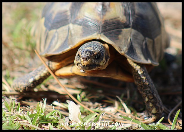
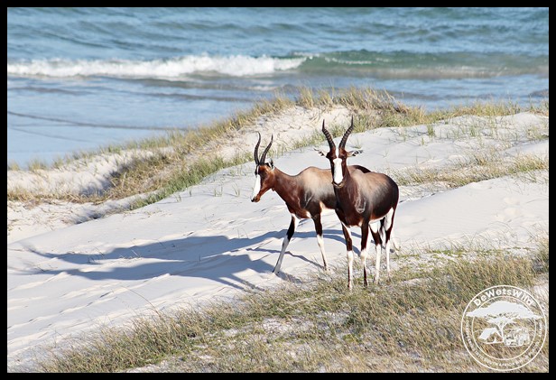
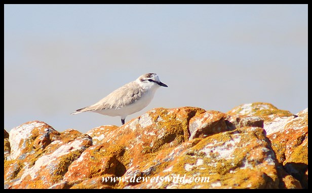
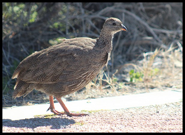
Notably, Tsitsikamma’s list of recorded mammals is dominated by marine animals rather than the large terrestrial game species normally associated with a national park in Africa. That being said, visitors should count themselves lucky to see one of the seven whale or five dolphin species that ply these waters – we were fortunate to see a pod of Indian Ocean Bottlenose Dolphins in the surf and a handful of Humpback Whales breaching far into the sea. On land however the Chacma Baboons and Rock Dassies are ubiquitous inhabitants of the camp. And with almost 300 bird species recorded, many of which closely associated with the ocean and rocky beaches, the Tsitsikamma section is a birdwatcher’s delight. Most of the Garden Route National Park’s 25 species of snakes are seldomly seen, so we were thrilled to witness an altercation between a deadly venomous Boomslang and Southern Boubou while walking around one morning.

Walking around after dark, and seeing the healthy population of frogs and toads at Storms River Mouth, we realised how grossly inadequate our old guidebook on South Africa’s amphibians was to identify the 24 species that’s been recorded in the Garden Route National Park. We remedied that soon after we got back home!

As already mentioned, Storms River Mouth Rest Camp is the Tsitsikamma section’s main visitors facility and understandably one of the Garden Route’s top attractions. Here, wedged between mountain and sea, overnight visitors have a choice of spectacularly located accommodation and camping sites, serviced by a restaurant and shop that stocks basic food items and curios. There are picnic sites for day visitors and a small swimming beach. Guided boat tours and more adventurous activities up the Storms River gorge can be undertaken daily. Unique snorkeling and scuba trails allow visitors a glimpse into the underwater world of the Tsitsikamma, and on land several walking trails lead deep into the forest. At the eastern side of the Tsitsikamma section lies the more rustic Nature’s Valley Rest Camp, just outside the small holiday town of the same name. The renowned Otter Trail, covering a distance of almost 50km between Storms River Mouth and Nature’s Valley over 5 days, is rated as one of the best and most scenic hiking routes on the planet.

Storms River Mouth was the sixth destination on our December itinerary through eight of South Africa’s national parks. It is easily accessible along a good tarred road that turns off the N2 highway between Plettenberg Bay and Port Elizabeth.

Diepwalle (Garden Route National Park)

Originally, most of South Africa’s Garden Route between the mountains and the sea was covered by dense forests. Unfortunately these forests have been exploited on an industrial scale for wood and ivory since the 1760’s and the town of Knysna owns its existence to the lucrative trade that required access to a harbour for exporting. At various times attempts were made to protect pockets of forest from harvesting, but it is not until the 1880s, when a professional forester was appointed as superintendent by the colonial government, that any real effort went into the protection and sustainable use of what remained. Today only about a third of the indigenous forests remain, with a large proportion of it being protected in the Garden Route National Park, proclaimed in 2009 when several state forests were amalgamated with the Wilderness and Tsitsikamma National Parks and the Knysna National Lake Area.

North of Knysna, the Diepwalle State Forest was one of those pockets of forest afforded protection. One of the main attractions here is the enormous King Edward VII-tree, an Outeniqua Yellowwood tree estimated to be over 600 years old, towering almost 40m above the forest floor and so named by a group of British officials who were entertained to a picnic here in 1924. Diepwalle is also known to be part of the range of the last few remaining Knysna Elephants. In the 1880s it was estimated that between 400 and 600 elephants still roamed the Garden Route, yet today, a little over 100 years later, there may be only one lone cow remaining (even elephant researchers and park staff differ on exactly how many are left). Unless they are exceptionally lucky, the only contact visitors are likely to have with a Knysna Elephant is not along the Elephant Walk trail through the forest, but rather with the skeleton of one that is on display at the Forest Legends Museum at Diepwalle.

Diepwalle is easily accessible from Knysna, a short drive along the gravel R339 (Prince Albert’s Pass) leading to Uniondale. We spent a morning in the area while on our December holidays visiting eight of South Africa’s national parks. Guests can stay a night or two here on the unique camping decks set among the trees in the deep forest shade. Apart from the fascinating museum, there’s also picnic sites and a community-run tea garden serving delicious treats.


Wilderness (Garden Route National Park)

South Africa’s Garden Route is a 300km stretch of diverse and exceptionally scenic coastline between Mossel Bay in the west and the Storms River in the east, sandwiched between the Outeniqua and Tsitsikamma mountains and the Indian Ocean. The process of protecting the Garden Route from exploitation and human encroachment has been a long one, and is still ongoing. From the 1960’s various small pieces of the area east of the small holiday town of Wilderness received formal protection, culminating in these being amalgamated into the newly proclaimed Wilderness National Park in 1987 and the years thereafter. In March 2009, the erstwhile Wilderness National Park became an integral part of the expanded Garden Route National Park (covering a total of over 1,500km²), when it was joined with the Knysna National Lake Area and Tsitsikamma National Park through the proclamation of enormous tracts of state-owned land joining them.

The Wilderness section of the Garden Route National Park is centered on South Africa’s very own “Lakes District”. The original area encompassed by the Park straddles six lakes (Groenvlei, Bo-Langvlei, Langvlei, Rondevlei, Swartvlei and Island Lake), the Wilderness Lagoon, Serpentine and Touw Rivers, indigenous forests, and both rocky and sandy beaches along the coastline.

Before the Wilderness National Park was proclaimed, the area where the Garden Route National Park’s Ebb-and-Flow Rest Camp is situated today was the Ebb-and-Flow Nature Reserve (administered by the George municipality and today Ebb-and-Flow North) and the private Siesta Caravan Park (today Ebb-and-Flow South).

Birdwatchers and photographers are in for a treat when visiting any of the three hides next to the lakes in the Wilderness section of the Garden Route National Parks. We had time to visit two of them in December – Malachite (on Langvlei) and Rondevlei, and could easily have spent all day at either.

Given the amazing diversity of habitats in the park, it is no surprise that the Wilderness section of the Garden Route National Park abounds with a wide variety of birdspecies, and while the area doesn’t support much in the way of large mammals apart from shy bushbuck, bushpigs and very seldomly seen leopards, it does give visitors the opportunity to walk around unhindered looking for the smaller fry.

Ebb-and-Flow Rest Camp is the Wilderness section’s main visitor node. Here there are accommodation and two expansive camping areas for overnight guests, a newly opened picnic area for day visitors, and canoes for hire to explore the Touw and Serpentine Rivers. A network of walking trails of varying length traverse the area, many of them starting at or near Ebb-and-Flow. The Park also has several beaches for sun-seekers and bathers. Privately-run accommodation establishments and camping sites, shops, restaurants, fuel stations and more are available in the nearby towns of Wilderness and Sedgefield.

The Wilderness section of the Garden Route National Park is easily accessible along the N2 highway running from Cape Town to Port Elizabeth, and is just a few minutes’ drive from the airport at George. We recently spent three nights camping in the lovely Ebb-and-Flow North camp, the fifth stop on our 2017 summer holidays in eight of South Africa’s national parks.

Angulate Tortoise

Chersina angulata

The most commonly encountered tortoise in the thickets, fynbos and karoo scrub of South Africa’s south-western corner, Angulate Tortoises show a marked preference for sandy areas, and feed on grasses, annuals and succulents. They drink water through their nostrils! Adult male Angulate Tortoises are noticeably larger than the females, grow to as much as 30cm in length and can weigh up to 1.5kg, which is unusual as females are bigger than males in most other tortoise species.

Adults are usually solitary, except when mating, and have small home ranges of up to only 2 hectares. Angulate Tortoises are diurnal, often hiding under vegetation, among rocks or in holes in the ground during the hottest parts of the day or in bad weather. To escape danger they will retract their head, neck and limbs into the shell and will squirt the contents of its bowels if picked up.

Both sexes reach breeding age at between 10 and 12 years old. During the mating season, which spans spring and summer, males will engage in intense fights for dominance and try to flip each other over (with some effort they are normally able to get back on their feet). After mating, females can delay fertilisation until favourable environmental conditions prevail, which is normally just after rain has softened the soil. She then digs a small hole, lies a single egg weighing between 20 and 25g, fills the hole back up and taps the soil down with her shell. Under favourable conditions females can lay up to 6 eggs in a season. Incubation takes 90 to 200 days, depending on ambient temperatures, and when the tiny hatchlings emerge they weigh only 8-12g.

The Angulate Tortoise is commonly seen in parts of the Eastern, Western and Northern Cape Provinces, as well as in southern Namibia. The IUCN considers it as being of least concern as it is very numerous with few significant threats (such as habitat destruction and the illegal pet trade) to its continued survival. They are unfortunately very prone to dying in wildfires. The Angulate Tortoise has a life expectancy in the wild of around 30 years.

The results of the 2017 South African Blog Awards have been announced!

And we are thrilled to have been voted the Winners in both the Best Environmental Blog and Best Travel Blog categories!

Thank you so very much to everyone that voted for us in this competition. Without your support and encouragement this would not have been possible. We hope to continue sharing our love for South Africa’s wild places (and the creatures that find a safe haven there) with you for a very long time to come!

Our sincere congratulations to all the winners and runners-up in every category, and our thanks as well to the organizers and judges of the 2017 SA Blog Awards.

Bontebok

Damaliscus pygargus pygargus

The Bontebok is a medium-sized antelope endemic to a small piece of South Africa’s southern coast and adjacent interior, stretching from Caledon in the west to Mossel Bay in the east, and from the Langeberg Mountains southwards to the ocean both east and west of Cape Agulhas. Considered abundant in early colonial times, hunting, competition for grazing with domestic stock and loss of habitat almost drove it to extinction. The IUCN considers the Bontebok’s conservation status as “Vulnerable” due to its restricted distribution, fragmented and transformed habitat, low numbers and the threat of hybridisation with the closely related (at subspecies levelBlesbok. The effort to save the Bontebok from extinction became a national priority in the 1930’s with the proclamation of the Bontebok National Park (read here for more). While there may now be as many as 3,500 Bontebok in the country, many of these are on private properties both within and outside their historical range and may possibly be hibridised, with only approximately 700 or so individuals tested for genetic purity and occurring at four formally protected areas (of which Bontebok National Park is one) within the historic distribution of the species. The Cape of Good Hope section of the Table Mountain National Park is another good place to see Bontebok, but that population is considered to be outside their natural distribution range.

Bontebok are almost exclusively grazers, showing a preference for areas of short grass and recently burnt veld, usually in open, undulating areas with good visibility in the heathland (fynbos and renosterveld) that cover their limited distribution range. They are dependent on easily accessible water sources and stay within 1.5km from a reliable supply, especially in the dry season. Thickets are important as refuges from cold weather. Bontebok stand around a meter high at the shoulder and weigh around 60kg.

From about the age of 5 years, adult Bontebok rams establish small territories (4 to 30 hectares) which they mark with dung heaps and defend throughout the year, and in which they attempt to keep breeding herds consisting of ewes and lambs for as long as possible so as to mate with any receptive females. The females in the breeding herds, which number between 6 and 30 animals, maintain a strict hierarchy. Young rams, and older males displaced from their territories, roam together in bachelor herds which are often even bigger than the breeding herds. The rutting season peaks from January to March, with most lambs being born in September and October. Ewes give birth to single lambs weighing around 6kg that can run with the herd within an hour of birth!

Bontebok National Park

The Bontebok, a colourful antelope endemic to the Western Cape of South Africa, roamed the area between the present towns of Caledon and Mossel Bay in their thousands at the time the Dutch first established their trading post at Table Bay in 1652. Uncontrolled hunting however quickly led to the population crashing, and despite conservation minded farmers’ best efforts only 121 Bontebok remained by 1927. In 1931, the precarious situation of the Bontebok moved the National Parks Board to establish the Bontebok National Park on an area of 722 hectares outside Bredasdorp, with a founding population of just 17 animals. This area however was poorly chosen, and the animals suffered from disease and poor grazing. It was decided to find an alternative location for the Park, and in 1960 the present site on the outskirts of Swellendam was proclaimed as the Bontebok National Park with a population of 61 of its most precious charges that survived the translocation. Covering 3,900 hectares with little prospect of further expansion due to it being surrounded by the town and croplands, the Bontebok National Park is South Africa’s smallest National Park. Here the Bontebok thrived, and when the Park reached its carrying capacity of about 250 Bontebok, animals could be donated and sold for reintroduction to other parts of their historic range. More about the Bontebok in our next post.

The recorded history of the area that today encompasses the Bontebok National Park dates back much further than that though. By the time the Dutch settled in the Cape, this area was already inhabited by the Hessequa, a Khoekhoen tribe, that moved into the area about 2000 years earlier and was very successful farmers with healthy herds of especially cattle and sheep. The Hessequa clans lived in settlements known as “kraals”, under the leadership of “captains” controlled by a powerful chief. Lang Elsie, who lived between 1734 and 1800, was notable for being a female captain and her kraal was located on the banks of the Breede River, near the site now occupied by the Park’s tourist accommodation. Today, the remains of Lang Elsie’s small stone house can be seen a short walk away from the rest camp that carries her name, while efforts are being made to restore the open site where her followers lived in traditional huts made of sedge thatch. The Dutch started trading with the Hessequa in the 1660’s, and as the years progressed more and more European settlers moved into the area, leading to the establishment of Swellendam in 1746. By the end of the 18th century, Western “civilisation” had brought an end to the traditional lifestyle of the Hessequa Khoekhoen. Those that survived waves of disease epidemics were forced into life on farms or on mission stations.

The Bontebok National Park is largely flat, ranging in altitude between 60 and 200m above sea level. In the south, the broad and slow Breede River is a permanent feature. To the north, the Langeberg mountain range lies outside the Park. Most of the Park’s vegetation is classified as fynbos, mostly low growing, with thickets of various tree species lining the river. About 470 indigenous plant species have been recorded in the Park; with most of the surrounding areas being intensively farmed this pocket of natural vegetation is extremely valuable. Unfortunately the alien invasive water hyacinth is proving difficult to eradicate from the river.

While the Bontebok remains the Park’s star attraction among the 36 kinds of mammals that find refuge here, there’s several other kinds of non-threatening large game animals that may be encountered, and over 200 bird species have been recorded. There’s also 28 kinds of reptiles, but apart from the ubiquitous Angulate Tortoises most are rarely seen. Ten species of amphibians and twelve species of fish (6 of which is exotic) also occur at Bontebok National Park.

Overnight visitors to Bontebok National Park’s Lang Elsie’s Kraal Rest Camp have the option of camping or staying in one of the 14 comfortable chalets with either 1 or 2 bedrooms. Day visitors are well taken care of at the picnic area at Die Stroom next to the Breede River. Visitors are welcome to walk and cycle through the Park, with several well-marked trails at their disposal, or swim, canoe and fish in the river. There is also a limited network of gravel game-viewing roads, for the most part easily negotiable in a sedan. Shops, restaurants, fuel and other services are available in Swelledam, just a few minutes from the Park’s entrance gate on the N2 highway.

Bontebok National Park is located just outside the town of Swellendam, with the entrance gate less than a kilometre from the N2 highway leading to Cape Town, about 240km away. Bontebok was the fourth destination on our December holiday tour of eight of South Africa’s national parks. Unseasonably wet weather severely curtailed our explorations of this Park during the two days we had available there, so we will just have to return for more!


White-fronted Plover

Charadrius marginatus

Usually seen in pairs or small flocks, the White-fronted Plover is a small (50g, wingspan 40cm) wading bird inhabiting mudflats, sandy beaches, and the shorelines of estuaries, large lakes and rivers, where it feeds on worms, snails, insects and crustaceans.

White-fronted Plovers nest in shallow scrapes in the sand, often quite exposed and usually far above the high-water mark. Pairs are monogamous and often stay together, in the same area, for many years. Nesting has been recorded throughout the year, but there is a definite peak in the spring and summer. Clutches consist of 1-3 eggs and are incubated by both parents for around a month. When threatened at the nest, the parents will cover the eggs with sand before fleeing. The precocious chicks feed themselves from birth and fledge when they are about 6 weeks old.

In South Africa, White-fronted Plovers occur all along the coast and along the rivers of the Lowveld. North of our borders, and south of the Sahara, the White-fronted Plover occurs along the Atlantic and Indian Ocean coastlines as well as most of the larger inland wetlands and rivers. While loss of habitat is causing the population of this species, currently estimated at around 100,000 birds, to decline, the IUCN considers it to be of Least Concern.

Cape Cormorant

Phalacrocorax capensis

The Cape Cormorant is strictly a marine species, usually foraging in large flocks within 10km from the coastline and very seldomly venturing inland to feed in freshwater environments. Two kinds of pelagic schooling fish, the anchovy and pilchard (sardine), form the staple of the Cape Cormorant’s diet and are pursued under water to depths of over 30m. Adults weigh as much as 1,6kg, with a wingspan of around a metre.

Cape Cormorants nest in large, densely packed colonies, often mixed with other kinds of seabirds and mainly on rocky islands and outcrops in the sea, inaccessible cliffs along the coast, or shipwrecks. They breed throughout the year, with a peak in spring and summer. Pairs are monogamous, with the males fighting for the best nest spots. Nests are built of seaweed and sticks. Clutches consist of 1-5 (rarely up to 7) eggs and are incubated by both parents for 3 to 4 weeks. Chicks fledge when they are about 9 weeks old and are then cared for by the parents for several more weeks.

The Cape Cormorant occurs along the entire coastline of Namibia and South Africa and only marginally into Angola and Mozambique, with some venturing as far north as the mouth of the River Congo. They are most common along the Atlantic (west) coast, with less than 1% of the breeding population occurring east of Cape Agulhas. The IUCN classifies the Cape Cormorant as Endangered, due to a massive decline in their population over the past 30 years brought on by overfishing, oil pollution and disease outbreaks. The total population is currently estimated at about 230,000 mature individuals, and still in decline.

Cape Spurfowl

Pternistis capensis

Cape Spurfowl, also known as Cape Francolin, inhabits areas of fynbos, heathland and semi-arid scrub, usually near a reliable water source, and also utilises nearby orchards, vineyards, cultivated fields, pastures and suburban parks and gardens. It has an omnivorous diet, feeding primarily on seeds, fallen fruits and berries and a wide variety of invertebrates. Male Cape Spurfowl are quite a bit bigger than the females and may weigh up to a kilogram.

The breeding season for Cape Spurfowl commences in early spring but stretches right through to the end of summer. The nest is a simple scrape in the ground, hidden among vegetation, in which the female incubates a clutch of 1-4 eggs for around 3 weeks. Larger clutches of up to 14 eggs have been recorded, but are thought to be of multiple females laying in the same nest.

The Cape Spurfowl’s distribution is mainly centred on South Africa’s Western Cape Province, extending into adjacent areas of the Eastern and Northern Cape, and reaching southern Namibia along the course of the Orange River. With a common and stable population, the IUCN considers the Cape Spurfowl to be of least concern.