Monthly Archives: January 2013

Flowers

These waterlilies, photographed in the Ithala Game Reserve, grow in a pond overlooked by Ntshondwe Camp’s restaurant’s deck, adding to the tranquil atmosphere while enjoying a meal in the great outdoors!

wwpc_Flowers1

wwpc_Flowers2

We’re participating in the online adventure travel and photography magazine LetsBeWild.com‘s Wild Weekly Photo Challenge for bloggers. This week’s challenge is “Flowers

Now!

We’ve just returned from a morning outing in the Moreletakloof Nature Reserve near our home, where we encountered this zebra. If you’d like, there are more photos from our trip here.

NOW

We’re participating in the online adventure travel and photography magazine LetsBeWild.com‘s Wild Weekly Photo Challenge for bloggers. This week’s challenge is “Now

Moreletakloof – 27 January 2013

Probably the best thing about living in Pretoria is that there’s a bunch of nature reserves very near to us. The tiny (100 hectare) Moreletakloof Nature Reserve is just one example: it is only 2.6 kilometers from our home, and early this morning Joubert and I headed there for a bit of walking. Despite it being overcast and drizzling we had a thoroughly enjoyable father-and-son experience, encountering a variety of birds and animals along the trail.

Ostriches are frequently encountered in Moreletakloof, and can be dangerous when protecting chicks.

Moreletakloof_9710

Moreletakloof’s animals are quite habituated to the human presence

Moreletakloof_9712

Zebra foal with an irritating itch in the ear

Moreletakloof_9717

Impala

Moreletakloof_9731

More impala

Moreletakloof_9734

Red bishop

Moreletakloof_9735

And even more impala

Moreletakloof_9746

This small stream meanders from one end of the reserve to the other

Moreletakloof_9749

Trail through thicket

Moreletakloof_9770

Restored farmhouse from the late 1800’s now operating as a restaurant, with blesbuck grazing on the grounds

Moreletakloof_9778

Blesbuck

Moreletakloof_9780

Who’s watching who?

Love

Blue wildebeest whispering sweet nothings?

(Picture taken near Satara in the Kruger National Park)

Have a look at other bloggers’ interpretation of this week’s theme “Love”.

Shingwedzi flooded – January 2013

Photos have been posted on the SANParks forum of the flooding that hit Shingwedzi Rest Camp in the Kruger National Park – click on the image below to see more.

Extensive flooding at Shingwedzi – published on the SANParks forum

Severe flooding strikes two of our National Parks

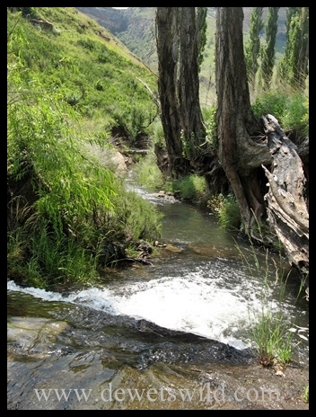
Days of torrential rain in South Africa’s northern provinces have caused severe flooding in two of the country’s National Parks – Mapungubwe and Kruger. It appears that our beloved Shingwedzi Rest Camp has been hit exceptionally hard, with about 70 staff members and their families having to be airlifted to safety from there this morning, just hours after the guests staying in the camp were safely evacuated by road. We have seen the Shingwedzi area being flooded in January of 2006, though the camp itself was never inundated then, and can only imagine what these people had to endure overnight. We are immensely grateful for their safety.

Flooding in Kruger National Park – photograph published by SANParks on their facebook page (click on the image for more)

South African National Parks have posted the following media updates:

———————————————————————————————————————————————————————-

Update on the Mapungubwe floods

Date: 21st January 2013

The recent heavy rains experienced in most parts of the country have resulted in the sudden temporary closure of the Mapungubwe National Park and World Heritage (MNP& WH) site. The park is inaccessible from Musina, as roads leading to the area are washed away.

In the last week, most of the roads within the Park were temporarily closed but the subsequent rains that were received in the area over the last 72 hours, caused the park to be closed temporarily until further notice.

According to Divhani Maremba, spokesperson for the MNP&WH, “most clients who were in the Park at the time are currently safely kept at Leokwe camp. Some tourists who were booked in the park last night and today were asked to postpone their holidays. We appeal to all the people to be very cautious when approaching the area.”

“Although some people cannot be contacted through mobile phones because of network coverage, we are constantly monitoring the situation around the park to ensure that we keep everyone informed of developments. Our emergency personnel are also on site trying to prevent potential disaster,” said Maremba.

“More rain is expected over the next two days and we advise all the people with confirmed bookings in the immediate future to contact our reservations office about the status of their bookings as the Park will be temporarily closed until further notice,” she concluded.

More information will be provided in this regard on the SANParks website periodically and on all social media platforms belonging to the organisation.

Issued by:
SANParks

Media enquiries:
Divhani Maremba
Manager: Northern Regions Communications.
Tel: 012 426 5170; Cell: 082 941 9980
Email: divhani.maremba@sanparks.org

Or

Gabrielle “Gabby” Venter
Manager: Media and Stakeholder Relations.
Tel: (012) 426 5065; Cell: 083 825 9435
Email: gabrielle.venter@sanparks.org

——————————————————————————————————–

Update on the heavy rains in the KNP

Date: 21st January 2013

Members of the KNP Disaster Committee met early this morning to assess the impact of the heavy rain in the Kruger National Park (KNP).

Members briefed the committee on their initial inspections and assessments regarding roads, water and sewerage, vehicle fleets, electrical and mechanical as well Protection through the Operation Centre, that has been set up in the Park.

There have been no reports of any major incidents throughout the park except the ones listed below.

Tshokwane: The low-level bridge to staff and ranger houses were reported as over flowing, resulting in personnel being trapped at the picnic site and others at houses, but their lives are not threatened.

Olifants and Sweni trails: Eleven tourists who were trapped on these trails have been safely airlifted to Satara.

Tamboti: The camp is isolated with 8 guests and staff including the section ranger. The water levels are being constantly monitored and a rescue plan will be executed to airlift them to Satara.

Talamati, Biyamiti: The camps have been closed and guests moved to the safety of Satara and Berg-en-Dal.

Houtboschrand: Four patrol rangers and a SANDF unit are stuck in the area, they are in constant contact with the Section Ranger and will be assisted.

Muzanzene: Four guests and one staff member have been air-lifted to safety.

Shingwedzi: All guests were evacuated to Mopani last night. 70 staff members are currently being evacuated.

Roads

H1/1 link road between Skukuza and Pretoriuskop has been closed off due to the heavy current over the low level bridge.

Crocodile Bridge Gate is overflowing and as a result the camp has been isolated and no cars are allowed through.

Lucy Nhlapo: Regional Manager Marula: KNP has reiterated her appeal to all visitors to the Park to stick to the tarred roads as all gravel roads have been closed for safety reasons.

At this stage all is still in order at the Skukuza Rest Camp, the biggest in the Park,  with the  Nwatsishaka river level slowly rising but flowing steadily, however the low level bridge is currently closed as water is overflowing at high velocity, while the high level bridge is being  constantly monitored.

Northern KNP:

The Northern part is still experiencing heavy downpours and the bush camps are still out of bounds. Visitors are still urged to drive only on tarred roads.

Camps and Facilities Closed:

  • Sirheni,
  • Shimuwini,
  • Shingwedzi
  • Bateleur
  • Boulders
  • Tamboti
  • Talamati
  • Muzanzane
  • Biyamiti
  • Crocodile Bridge
  • Makhadzi Picnic Spot
  • All trails camps and Wilderness Safaris

Gates Closed:

  • Crocodile Bridge
  • Orpen
  • Punda Maria
  • Pafuri
  • Giriyondo Port of Entry
  • Pafuri Port of Entry

Roads Closed:

  • H1 – 2 Sand River & Sabie Low water bridge – alternatively motorists can use H12
  • H1/1 link road between Skukuza and Pretoriuskop has been closed off due to low level bridge overflowing.
  • H1-1 – Pretoriouskop to Malelane T-Junction
  • H10 – Lower Sabie to Tshokwane
  • H7 – Satara to Orpen
  • H1 – 9 – Pafuri entrance to Punda
  • H15 – Punda Maria to Shingwedzi
  • H1 – 6 Letaba to Mopani
  • Nwaswitshaka low level bridge.

NB: All gravel roads in the park have been closed off for safety and motorists are requested to stay on tarred road.

“Generally our emergency plans are running accordingly and we’re constantly monitoring the developments, if anyone requires an update, our emergency 24hour hotline is available 013 735 4325. Please call to check on the conditions in the area you intend visiting” concluded Lucy Nhlapo.

Issued by:
SANParks

Media Enquiries:
Reynold “Rey” Thakhuli
GM: Media Liaison
Tel: 012 426 5170;  Cell: 073 373 4999
Email: rey.thakhuli@sanparks.org 

Ike Phaahla
SANParks Media Specialist
Tel: 013 735 4300; Cell: 0836736974
Email: isaac.phaahla@sanparks.org 

Travel and Tourist Enquiries:
Emergency 24 hour hotline: 013 735 4325

Beyond (2)

Game viewing in the Moreletakloof – a tiny nature reserve smack in the middle of Pretoria’s eastern suburbs.

(this is our second entry for this week’s challenge – have a look at the first if you’d like)

Have a look at other bloggers’ interpretation of this week’s theme “Beyond”.

Beyond (1)

A leopard stalking warthogs near Cape Vidal in the iSimangaliso Wetland Park. The leopard’s attack proved fruitless and in the end the hogs had their revenge, chasing the leopard back into the dune forest.

Have a look at other bloggers’ interpretation of this week’s theme “Beyond”.

People in Nature

Three generations of anglers setting out at dawn towards their favourite fishing spot at Cape Vidal, in the iSimangaliso Wetland Park.

(you can click on the image for a clearer view)

We’re participating in the online adventure travel and photography magazine LetsBeWild.com‘s Wild Weekly Photo Challenge for bloggers. This week’s challenge is “People in Nature

Golden Gate Highlands National Park – December 2012

Sandstone cliffs and rolling grasslands, painted in the warm golden glow of a Free State sunrise.

Golden Gate sunrise

Golden Gate sunrise

The Free State Province of South Africa has a reputation for being flat and featureless, and for the most part that is true. But in the east of the province the Maluti and Drakensberg mountain ranges rise to dizzying altitudes, and it is in the foothills of these majestic peaks that the Golden Gate Highlands National Park was proclaimed in September 1963.

GoldenGate__5966

Golden Gate scenery

Golden Gate is another of our favourite South African nature destinations and after a relaxed four hour drive from Pretoria we were overjoyed to be back at the quaint Glen Reenen Rest Camp, our home-away-from-home for three nights at the end of December 2012.

GoldenGate__5944

Glen Reenen

GoldenGate__6080

Glen Reenen

GoldenGate__6114

Glen Reenen

Glen Reenen, Golden Gate, December 2012

Rondawel in Glen Reenen

(Inside the Park accommodation is also available at the Golden Gate Hotel, the Highlands Mountain Retreat, and Basotho Cultural Village)

The mountainous landscape and grand sandstone rock formations, hundreds of millions of years old, is what Golden Gate is most famous for – with the iconic Brandwag Buttress standing guard over the Park being the star attraction.

Brandwag Buttress

Brandwag Buttress

GoldenGate__6027

Golden Gate scenery

GoldenGate_MushroomRocks

Mushroom Rocks

This is a summer rainfall area and there was water in abundance throughout the Park during our visit – water as fresh, cool and crystal clear as only a mountain spring can produce.

GoldenGate__5933

The Little Caledon River

GoldenGate__6018

Mountain stream

GoldenGate__6047

Stream flowing past Glen Reenen

GoldenGate__9590

Pure mountain water

As with all mountain areas one needs to be mindful that the weather can change very quickly and misty mornings are a regular occurrence, making for hazardous driving along the Lichens Pass that snakes through the reserve.

GoldenGate__5973

Clouds rolling in over Golden Gate Highlands National Park

GoldenGate__6133

Misty valleys along Lichens Pass

GoldenGate__9687

The sun trying to break through heavy cloud

There are numerous scenic hiking trails of varying length and difficulty along which the park can be explored, and horse-trails are on offer for both novice and experienced riders. Two short, tarred game-viewing drives loop across the plateaus near Glen Reenen, while a recent addition that should prove very popular in years to come is a photographic hide built at the Park’s vulture restaurant where carcasses are laid out to supplement the diets of two endangered vulture species that occur in the Park: the Cape Griffon and the Bearded Vulture.

GoldenGate__6048

Scenic hiking trail

GoldenGate__6092

Vulture hide

Of course, the Park also harbours a variety of other birds and animals, all adapted to the highlands environment.

GoldenGate__9492

Black wildebeest, with Brandwag in the background

GoldenGate__9497

Black wildebeest

GoldenGate__9547

Blesbok

GoldenGate__9584

Baboons regularly forage through the camp

GoldenGate__9609

Secretary bird

GoldenGate__9626

Red hartebeest

GoldenGate__9641

This serval was a pleasant surprise

GoldenGate__9652

Plains Zebra

GoldenGate__9658

Black-backed Jackal, the most often encountered of Golden Gate’s carnivores

GoldenGate__9685

Grey rhebuck, a mountain-loving antelope endemic to South Africa

While at Golden Gate we posted some pictures on a daily basis – have a look if you’d like to see more:

26 December

27 December

28 December

Unusual rock formations

The Golden Gate Highlands National Park will remain close to our hearts for as long as those mighty golden cliffs and grassy peaks tower over the wooded valleys, rolling fields and crystal streams in their shadow below!